A long trek in the north-eastern corner of the Nepal Himalaya. It was difficult, not only due to the damages made to the trail by the heavy monsoon weather in the summer of 2025 and unexpected intense snowfall at the end of October of this year, but also because of difficult decisions to be made we were confronted with. The true joy is the one shared with others, and because we have to evacuate B. to Kathmandu from Khambachen (in 1/3rd of the trek…) while the rest of the group went further. The success of making the whole route almost like planned had a bitter undertone…
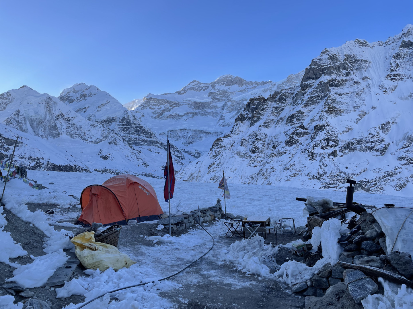
So, just like the featured image of this post: yes, this is the famous view of the Kangchenjunga massive, the third top of the world, seen from the hard-to-reach North Base Camp one clear morning and the visibility is perfect, but, unfortunately, you have to eliminate mentally the frozen ugliness of the messy camp surroundings so obvious in the sharp light of the morning… Not to mention the feeling you are just fulfilling the agreed journey program and there is nothing else… to enjoy. Sorry, but this is… just it.
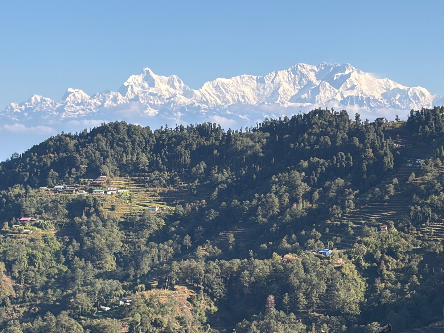
Pauwa Bhanjyang by Phidim :: the mighty Kangchenjunga view
The route we made followed roughly the newly established standard of a completely lodge-based trek in the Kanchenjunga area. The region is presently much more accessible than in the past due to new roads built to serve the construction of hydroelectric projects in the Tamor River valley. However, the transfer from the Bhadrapur airport deep in Terai lowlands takes by a car at least one and a half a day tackling the hills (better two and a half days!) via the bazaar town of Taplejung to reach the start point of the trek. Ironically, the small Taplejung airport is in practice almost never served because of too low passenger numbers (or any other excuse, the weather preferred). Anyway, the views of the Kangchenjunga massive from the south are as impressive as it takes. See the included picture — this is just what you see when you leave the breakfast table in a hotel situated on one of the high hill ridges.
The presently usual trekking trail starts from a place named Ranipul Hellok on a rough industrial road from Taplejung to Olangchung Gola and in the beginning it leads strictly along the Ghunsa Khola valley all the way northeast via Ghunsa up to Pangpema, a place better known as the Kangchenjunga North Base Camp. Afterwards, one retraces the trail back to Ghunsa and then takes a high traverse roughly southwards over mountain ridges with numerous and confusingly named passes — via Selele camp to Tseram in the Simbuwa Khola valley. From Tseram one can go up the valley to reach the view point of Oktang, again better known as Kangchenjunga South Base Camp, and come back to Tseram in the same way. From Tseram we went down the wild Simbuwa Khola valley via Tortong and Yasang to the starting point of our trek in Ranipul, and took a jeep ride again. (Please note, there is a possibility of an exit with an improved trail from Tortong over high ridge of Lasiya to Yamphudin roadhead.)
Here, a link to the OpenStreetMap centered on the Kangchenjunga top.
Everywhere along this trail it is presently possible to stay for the night in lodges during the trekking season, the one pictured below belong to the better ones.
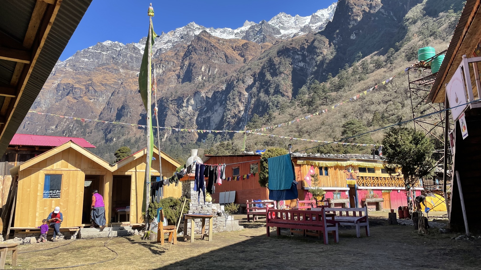
Ghunsa :: Dzongka Family House
The route
Shortly speaking — a small family trek done with the help of the Multi Adventure agency in Kathmandu. The route took us 25 days, counting with air/van/jeep transfers from and to Kathmandu, whereby some 21 days by foot. In the following, the main points quoted with altitudes in meters, overnight stays highlighted in bold font:
Kathmandu 1355 — flight to Bhadrapur 91 — drive via Ilam to Pauwa Bhanjang 2490 — drive to Taplejung 1820 — jeep drive along a rough road to Ranipul Hellok ~1550 — Sukhetum 1570 — along the Ghunsa Khola valley — Amjilosa 2460 — Gyabla ~2800 — Phale 3240 — Tashi Chholing Gompa — Ghunsa 3420 — side hike to a viewpoint ~3870 — Ghunsa 3420 — Khangpachen 4085 — hike to the Kumbhakarna Glacier Jannu sanctuary and a viewpoint ~4550 — Kambachen 4085 — B evacuation day, visiting the local Kambachen gompa — Khangpachen 4085 — Lhonak 4760 — Pangpema 5140 (vel North Kangchenjunga BC) — Lhonak 4760 — Khangpbachen 4085 — Ghunsa 3420 — Selele Camp 4210 — Sele La 4480 — Mirgin La 4620 — Sinelapcha La 4705 — Tseram 3850 — Ramche 4590 — Oktang ~4780 (vel South Kangchenjunga BC) — Ramche 4590 — Tseram 3850 — the Simbuwa Khola valley — Tortong 2980 — Yasang 2100 — Ranipul Hellok ~1550 — drive (with a vehicle change) via Taplejung, Ilam to Kanyam ~1550 — drive to Bhadrapur 91 and flight back to Kathmandu 1355.
Picture galleries
Three picture galleries from the trek, taken with three iPhones, a bit too lengthy, but, ehm, I cannot help:
- Stage 1 : Arrival – Ranipul Hellok – Sukhetum – Amjilosa – Phole – Ghunsa
- Stage 2 : Ghunsa – Khangpachen – Lhonak – Pangpema – Lhonak – Khangpachen – Ghunsa
- Stage 3 : Ghunsa – Selele – Tseram – Ramche – Oktang – Tseram – Tortong – Yasang – Ranipul Hellok – Return
There is also a post on my sister’s site, wholeheartedly recommended, especially the excellent(!) photo gallery: Kanczendzonga (you will be re-directed to another site).
Other remarks
The weather conditions on our trek were perfect, if not a bit too cold and snowy — the upper (>3500m) lodges and tea-houses were just closing because of that, it was the end of November. However, we were affected by the bad weather before our trek.
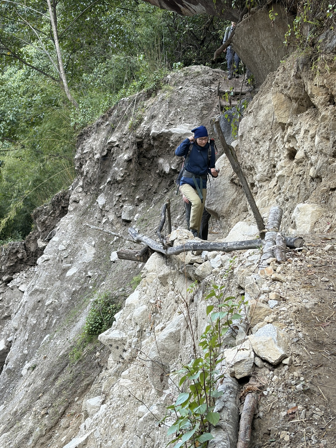
Sekathum-Amjilosa :: another fresh landslide
The heavy 2025 monsoon floods washed a few bridges on our route away, as documented on some of the picture galleries above, one not repaired on the Ghunsa Khola below Sukhetum, two with makeshift replacements built on the Simbuwa Khola below Tortong (it is not sure they can survive a next flood, however the construction of permanent ones is planned).
And — note well — virtually every day on the trek we were confronted with trail damage due to fresh landslides or an additional destruction of different sorts to the previously existing ones. The most monstrous landslides were to be circumvented by more-or-less permanent steep trails going high up from the river (or glacier moraine) level along the landslide edge only to drop back to the valley bottom behind it. The seemingly less dangerous landslides were crossed by traverses leading simply through the crumbling landslide surfaces, sometimes very narrow and inclined paths prone to be washed out by any next rain.
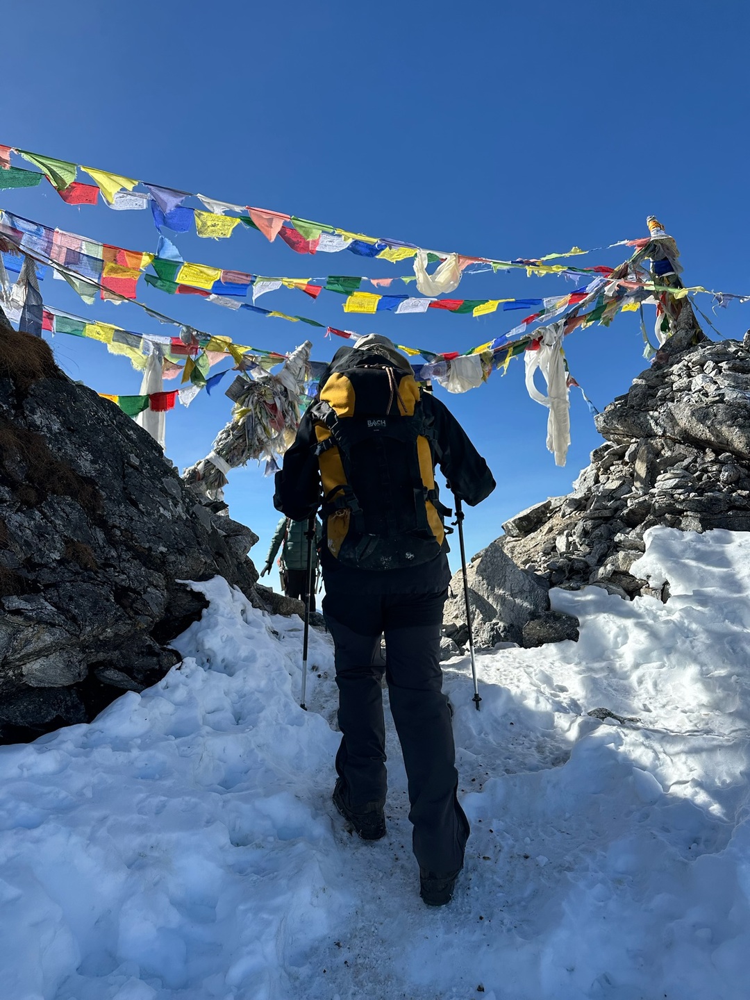
Sele La :: last steps below the pass
The snow cover caused by unexpectedly heavy snow falls in the late October was another problem above some ~4300m of altitude. At the beginning of our trek we met a few groups which had not managed to reach Pangpema due to deep snow and/or had been trapped in Lhonak due to intense snowfall — or otherwise had been stopped by a heavy rainfall in Tortong or Tseram on the way to the South BC. In the following good weather weeks, the snow did not melt thoroughly, but got iced with characteristic features reminding of penitents of the Andes when the snow alternately melted due to the strong sun during the days in the dry air and then got frozen during the nights. Additionally, the arbitrary tracks made by our precursors in the snow did not necessarily follow the paths on the ground and underwent the same melting-freezing procedure which formed ugly sink traps and slippery obstacles in the compressed and iced snow for moving ahead. Spikes do not help much in such situations, however they made us much happier by steep passages like moraine traverses or crossing high passes, see pictures. Anyway, sometimes on the endless snow fields I ended up in making my own trail instead of constantly slipping down from the iced trodden track and sinking in the mixture of deeper snow and hidden bushes below. So, enough complaining, simply some kind of winter conditions were present, slowing us down very efficiently.
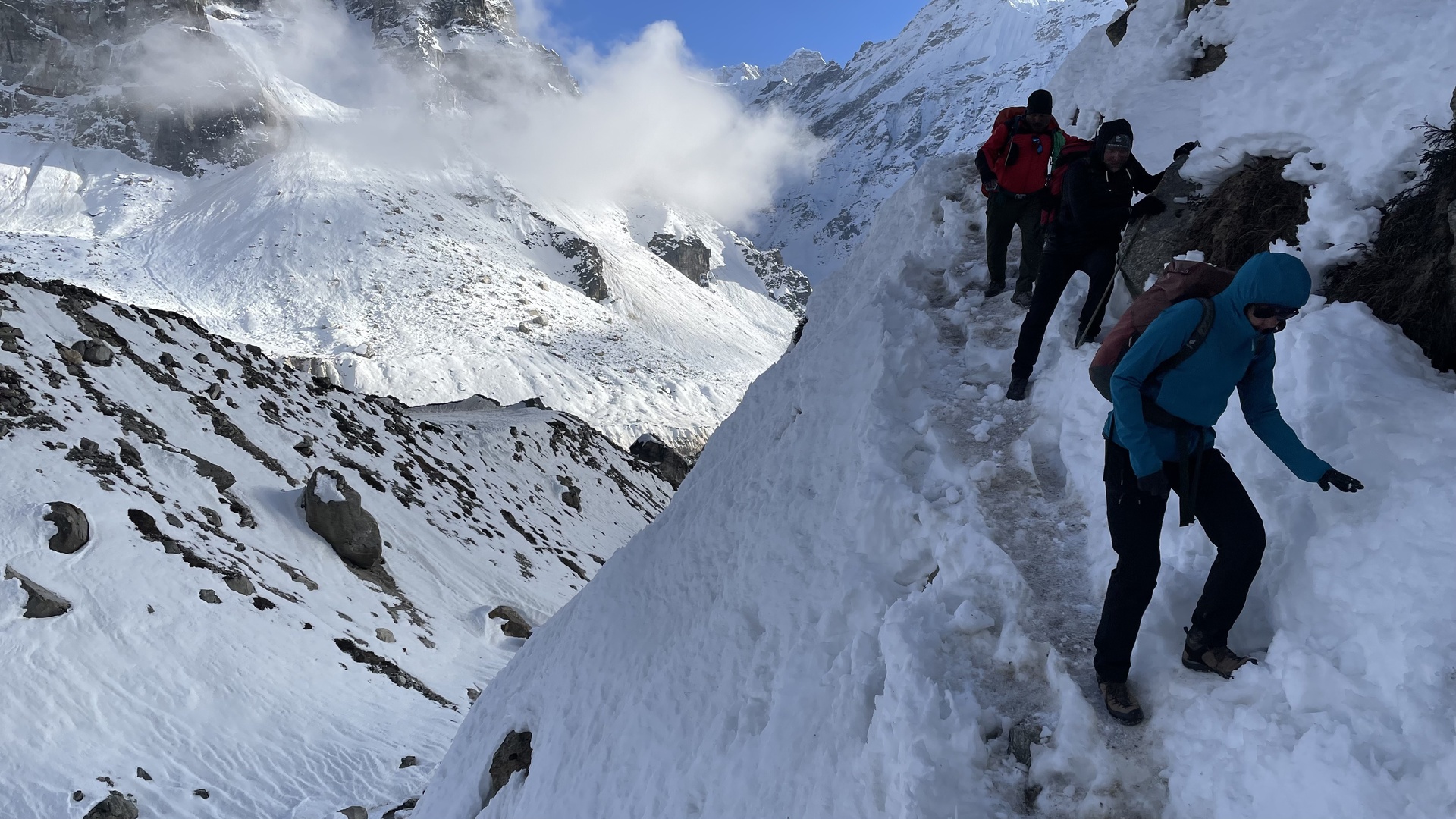
Khangpachen-Lhonak :: an ugly traverse
As the last remark, without the necessity (or possibility) of camping, the Kangchenjunga trekkers make daily stages from lodge to lodge which, however, are not necessarily well placed concerning the altitude difference optimal for the acclimatisation process. The traditional camping trek route allowed a relatively free choice of a camp with altitude differences of ~300m between them above ~3000m, which is presumed to be favourable for the step-by-step acclimatisation. From lodge to lodge one is presently forced to have 600m-700m differences in a few cases, independent from the fact in which direction you do the route. This makes the acclimatisation problematic and requires special attention.
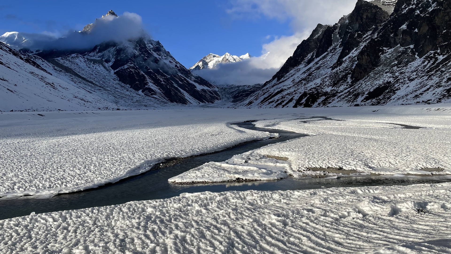
Lhonak plains :: iced snow fields :: Lashar peaks behind