Two weeks traveling in Iceland in the very middle of the crowded summer season.
At the beginning we have stayed for four short summer nights in a very nice large summer house named Sólvellir in the south-western Iceland, built on the forrested Skógarberg hill situated on the territory of Bergsstaðir farm. We reached it after a long evening drive from Keflavík (airport) discovering by the way the advantages of visiting acclaimed touristy places in an asynchronous mode to the crowds — late evening, early morning, or… midnight — there’s even enough light for making pictures.
Based there, on the first day we visited some of the attractions of the so-called Golden Circle: the trustworthy geysir Stokkur (a show each 7 minutes), Gulfoss and Faxi waterfalls, Þingvellir historical and geological site, towns Reykholt, Flúðir, Selfoss, the cathedral of Skálholt.
During the second day we made a trip towards Hekla in order to visit the northern part of the mighty Þjórsá River valley up to the Búrfell power plant visiting on the way the Gaukshövði viewpoint, Hjálparfoss waterfall, Stöng archeological site and the green Gjáin valley.
On the third day we made a hike to the table mountain Þórólsfell, just opposite the mighty glaciated volcano Eyjafjallajökull and the Þórsmörk valley. Yes, Eyjafjallajökull is the (in)famous volcano whose eruption in March 2010 threw so much fine ashes high into the atmosphere that disrupted air traffic all over the European continent.
Then we started a road trip staying mainly on campings, interrupted with short hikes to the surroundings. Being the first time on the island, but having two weeks only, we decided to leave the western fjords for a future trip. Taking advantage of the (limited) 4×4-capabilities of our car, allowing us to take gravel roads, we crossed the highlands on F35 road northwards from Gullfoss area via Kerlingarfjöll and Hveravallir directly to the north coast in order to make a clockwise trip roughly around the island trying at first to avoid so far as possible the ubiquitous Ring Road [1], but then forced to take it all the way along the eastern and western coast back to the city of Reykyavík for one afternoon before the flight.
The route of the road trip was (night stays in bold typeface):
Bergsstaðir — Gulfoss — over the gravel road [F35] to Kerlingarfjöll (sleeping in Ásgarður campsite and hiking in Hveradalir) — Hveravallir hot pot — the Blöndulón lake — Blönduós town, from where a side trip around the Vatsnes peninsula: Hvammstangi town, Illgustaðir seals site, Hvítserkur viewpoint, Borgarvirki fortress — then over Þverárfjallsvegur [744] — Sauðárkrókur town — Hólar with the old cathedral — around the Tröllaskagi peninsula with towns Hofsós, Siglufjörður, Ólafsfjörður, Dalvík — to Akureyri city — the Goðafoss waterfall — Aldeyjarfoss — Goðafoss again — the Mývatn Lake by Reykjahlið — hike up to the Vindbelgjarfjall top, hike in Dimmuborgir and in Krafla areas (Leirhnjúkur volcano) — the Dettifoss waterfall — Vesturdalur campsite — visit to Hljóðaklettar rocks — Ásbyrgi — hike to the Eyjan table mountain, the Botnstjörn Lake — Dettifoss — long route over the highlands on the road [1] — Egilstaðir city — Bakkagerði (disturbing puffins on the island of Hafnarhólmi in Borgarfjarðarhöfn) — Egilstaðir — Eastern Fjords all along the [1] road with the Vattarnes peninsula first, driven through towns Reyðarfjörður, Fáskrúðsfjörður, Stöðvarfjörður, Breiðdalsvík, Djúpivogur — the coast up to Stafafellsfjöll — upwards the valley of the Jökulsá í Lóni River — Kamar campsite — Höfn (langoustines!) — hike by Skálafell farm to Skálafellsjökull — Jökullsarlón — Fjallsarlón — Sandfell abandoned farm site — Svínafell village camping — Skaftafell visitor center — hike fo Svartifoss, Sjónasker, Sel — Kirkjubæjarklaustur — Vík — Reynisdrangar beach — Dyrhólaey — Vík — Þakgil — hike via Sker to Mýrdallsjökull edge — Þakgil –Hjörleifshöfði — Vík –Skógafoss — Seljandsfoss — Hvolsvöllur — Leirubakki — power plant Hellisheiðarvirkjun by Hveragerði — Reykyavík city — Keflavík
We had two cameras with us and three iPhones as well, which resulted in thousands of pictures to choose from. Overwhelmed by the fact and surprised by the quality of the iPhone photos, we decided to publish a timeline of our trip based on the seemingly spontaneous smartphone snapshots: Gallery (343 images)
 Þingvallavegur
 Þingvallavatn
 Geysir area :: almost midnight
 Geysir area :: Strokkur show
 Reykholt :: greenhouses, glasshouses, electric light by day as well
 Þingvellir :: the rift between the continental plates
 Þingvellir
 Þingvellir :: Logberg :: the flag where the Þing convened
 Þingvellir :: Logberg :: the flag where the Þing convened
 Þingvellir :: Öxará
 Þingvellir :: the rift between the continental plates
 Þingvellir :: Logberg :: the flag where the Þing convened
 Þingvellir :: Öxará
 Þingvellir :: Öxará
 South of Þingallavatn :: a power station
 Skálholt :: a turf roof church by the cathedral
 Skálholt :: sod roof church interior
 Skálholt :: sod roof church entrance
 Faxafoss
 Faxafoss :: note the fish ladder
 Tungufljót :: our bridge to our house
 Gullfoss
 Gullfoss
 Gullfoss
 Gullfoss
 Gullfoss
 Gullfoss
 Geysir area :: Strokkur at work, 23:08 hours
 Sólvellir house
 Sólvellir house
 Stóri Núpur :: Stóra-Núpskyrkja
 Stóri Núpur :: Stóra-Núpskyrkja :: at the cemetery
 Gaukshövði over the Þjórsá River :: Hekla in clouds
 Gaukshövði over the Þjórsá River :: show
 Gaukshövði over the Þjórsá River
 Hjálparfoss
 Stöng :: by the Rauðá river
 Stöng :: mushrooms!
 Stöng :: mushrooms!
 Gjáin :: the green valley
 Þjóðveldisbær :: a turf church
 Þjóðveldisbær :: inside the turf house
 Þjóðveldisbær :: a game
 Sólvellir house
 Sólvellir house :: breakfast
 F 261 towards Viðargil :: the valley opens
 Þórólsfell :: Markarfljót, Eyjafjallajökull
 Þórólsfell :: the Mögugil ravine we climbed along
 Þórólsfell :: searching for the view east
 Þórólsfell :: the flat top, Eyjafjallajökull
 Þórólsfell :: Mýrdalsjökull and Eyjafjallajökull over the Þórsmörk area
 Þórólsfell :: Mýrdalsjökull, Þórsmörk, Goðaland
 Þórólsfell :: Þórsmörk, Goðaland, Eyjafjallajökull slopes, the Markarfljót and Krossá rivers
 Þórólsfell :: Þórsmörk selfie
 Þórólsfell :: Eyjafjallajökull selfie
 Þórólsfell :: downwards, Markarfljót outflow to the sea
 Þórólsfell :: down along the ravine to Markarfljót
 Gluggafoss
 North od Gullfoss :: Kerlingarfjöll appears
 F 347 road :: the Jökulfall river waterfall
 F 347 road :: the Jökulfall river :: massive Hofsjökull behind
 Kerlingarfjöll :: Hveradalir :: down to the river, Mænir behind
 Kerlingarfjöll :: Hveradalir :: hot springs area and the bridge
 Kerlingarfjöll :: Hveradalir :: characteristic two hot spots
 Kerlingarfjöll :: Hveradalir :: a warm lake
 Kerlingarfjöll :: Hveradalir :: Snækollur appear left of Fannborg and Hverahnúkur
 Kerlingarfjöll :: Hveradalir :: a boiling lake above the hot springs valley
 Kerlingarfjöll :: Hveradalir :: just over the two hot spots
 Kerlingarfjöll :: Hveradalir :: muddy ridge edge, steep slopes on both sides
 Kerlingarfjöll :: Hveradalir :: almost by the bridge
 Kerlingarfjöll :: Hveradalir :: the river leads to Áskarður
 Kerlingarfjöll :: Áskarður
 Kerlingarfjöll :: Áskarður :: the Áskarðsá river
 Kerlingarfjöll :: Áskarður :: horses
 Kerlingarfjöll :: leaving :: Kjalfell mountain
 Kerlingarfjöll :: leaving :: Kjalfell mountain
 Fork F35/F347 :: turning north
 Hveravellir :: a hot spot in the middle of nowhere
 Hveravellir :: windy...
 Hveravellir :: another hot source
 Hveravellir :: hot springs and Langjökull glacier behind
 Hveravellir
 Hveravellir :: on F735 :: Kerlingarfjöll from the northwest
 Girsárlón
 Blönduóskirkja
 Hvammstangi :: drying fish
 Vatnsnes :: Illugastaðir :: drift wood
 Vatnsnes :: along Húnafjörður
 Hvítserkur
 Hvítserkur :: Sigriðarstaðaós outflow
 Hvítserkur :: the rock
 Hvítserkur :: the rock
 Hvítserkur :: Sigriðarstaðaós outflow
 Þverárfjall :: crossing Skagi peninsula eastbound
 Skagarfjörður top
 Hólar :: camping
 Hólar :: camping
 Hólar :: turf houses
 Hólar :: a turf house edge
 Hólar :: the cathedral church
 Hólar :: the church interior
 Hólar :: altar
 Hólar :: the old icelandic bible
 Hólar :: the epitaph of Ingibjörg Benediktsdóttir, bishop Gísli Þorláksson wife
 Hólar :: an angel
 Hólar :: the cathedral church
 Víðimýrarkirkja
 Víðimýrarkirkja :: the turf walls and roofs
 Víðimýrarkirkja
 Víðimýrarkirkja :: interior
 Víðimýrarkirkja :: interior
 Víðimýrarkirkja :: 18th century document
 Víðimýrarkirkja :: the altar
 Víðimýrarkirkja :: the altar
 Hofsós
 Tröllaskagi :: driving
 Tröllaskagi :: Miklavatn
 North of Dalvík :: misty Eyjafjörður
 North of Dalvík :: misty Eyjafjörður
 North of Dalvík :: misty Eyjafjörður
 North of Dalvík :: misty Eyjafjörður
 North of Dalvík :: misty Eyjafjörður :: Hrisey
 Akureyri :: Hafnarstræti :: a typical house
 Akureyri :: ice cream!
 Goðafoss
 Goðafoss
 Goðafoss :: photographers
 Goðafoss :: selfie!
 Aldeyjarfoss :: flat surrounding plane
 Aldeyjarfoss :: full setting
 Aldeyjarfoss
 Aldeyjarfoss
 Aldeyjarfoss
 Ingvararfoss above Aldeyjarfoss
 Aldeyjarfoss :: bivouac
 Aldeyjarfoss
 Vindbelgjarfjall :: starting from Vagnbrekka
 Vindbelgjarfjall :: starting from Vagnbrekka
 Vindbelgjarfjall :: on the northwestern slopes
 Vindbelgjarfjall :: small craters all around
 Vindbelgjarfjall :: on the top
 Vindbelgjarfjall :: top :: looking west
 Vindbelgjarfjall :: top :: looking west, Mývatn
 Vindbelgjarfjall :: descending
 Vindbelgjarfjall :: descending
 Dimmuborgir
 Dimmuborgir
 Dimmuborgir
 Dimmuborgir
 Dimmuborgir
 Krafla :: Víti crater
 Krafla :: Víti crater
 Krafla :: Kröflustöð power station
 Krafla :: fragile plants
 Krafla :: Hófur
 Krafla :: Hófur
 Krafla :: Hófur
 Krafla :: Leirhnjúkur :: looking northwest
 Krafla :: Leirhnjúkur
 Krafla :: Leirhnjúkur :: looking south
 Krafla :: Leirhnjúkur slopes
 Dettifoss
 Dettifoss
 Dettifoss
 Hljóðaklettar :: camping
 Hljóðaklettar
 Hljóðaklettar
 Ásbyrgi :: Eyjan
 Ásbyrgi :: Eyjan :: canyon walls
 Ásbyrgi :: Eyjan :: looking north
 Ásbyrgi :: Eyjan :: southern mountain tip
 Ásbyrgi :: Eyjan :: looking south to the end of the canyon
 Ásbyrgi :: Eyjan :: mountains to the northeast
 Ásbyrgi :: Eyjan :: along the mountain wall
 Ásbyrgi :: the Botnstjörn lake
 Ásbyrgi :: the Botnstjörn lake
 Ásbyrgi :: the Botnstjörn lake
 Ásbyrgi :: the Botnstjörn lake
 Ring road by the F88 fork towards Askja
 By Þjóðfell :: approaching the western fjords (and mist)
 Bakkagerði :: Hofnarhólmi puffins colony
 Bakkagerði :: Hofnarhólmi puffins colony
 Bakkagerði :: Hofnarhólmi puffins colony
 Bakkagerði :: Hofnarhólmi puffins colony
 Bakkagerði :: Hofnarhólmi puffins colony
 Bakkagerði :: Hofnarhólmi puffins colony
 Bakkagerði :: Hofnarhólmi puffins colony
 Bakkagerði :: Hofnarhólmi puffins colony
 Bakkagerði :: Hofnarhólmi puffins colony
 Bakkagerði :: Hofnarhólmi puffins colony
 Bakkagerði :: Hofnarhólmi puffins colony
 Bakkagerði :: Hofnarhólmi puffins colony
 Bakkagerði :: Hofnarhólmi puffins colony
 Bakkagerði :: Hofnarhólmi puffins colony
 Bakkagerði :: camping
 Bakkagerði :: Álfaborg
 Bakkagerði :: Álfaborg
 West of Bakkagerði :: a cloud over the Selfljót
 East fjords by Vattarnes
 Berufjörður :: salmon farming
 Approaching Hvalnes
 Lón flats
 Smiðjunes :: camping
 Smiðjunes :: camping
 Smiðjunes :: camping
 Smiðjunes :: camping
 Smiðjunes :: Jökulsá i Lóni valley
 Smiðjunes :: camping surrounding
 Smiðjunes :: Jökulsá i Lóni valley outlet by Stafafell
 Smiðjunes :: Jökulsá i Lóni valley
 Smiðjunes :: Jökulsá i Lóni valley
 Smiðjunes :: camping surrounding
 Jökulsá i Lóni by Stafafell
 Ring Road east of Höfn
 Skálafell :: Ice Age Morraine
 Skálafell
 Skálafell
 Skálafell
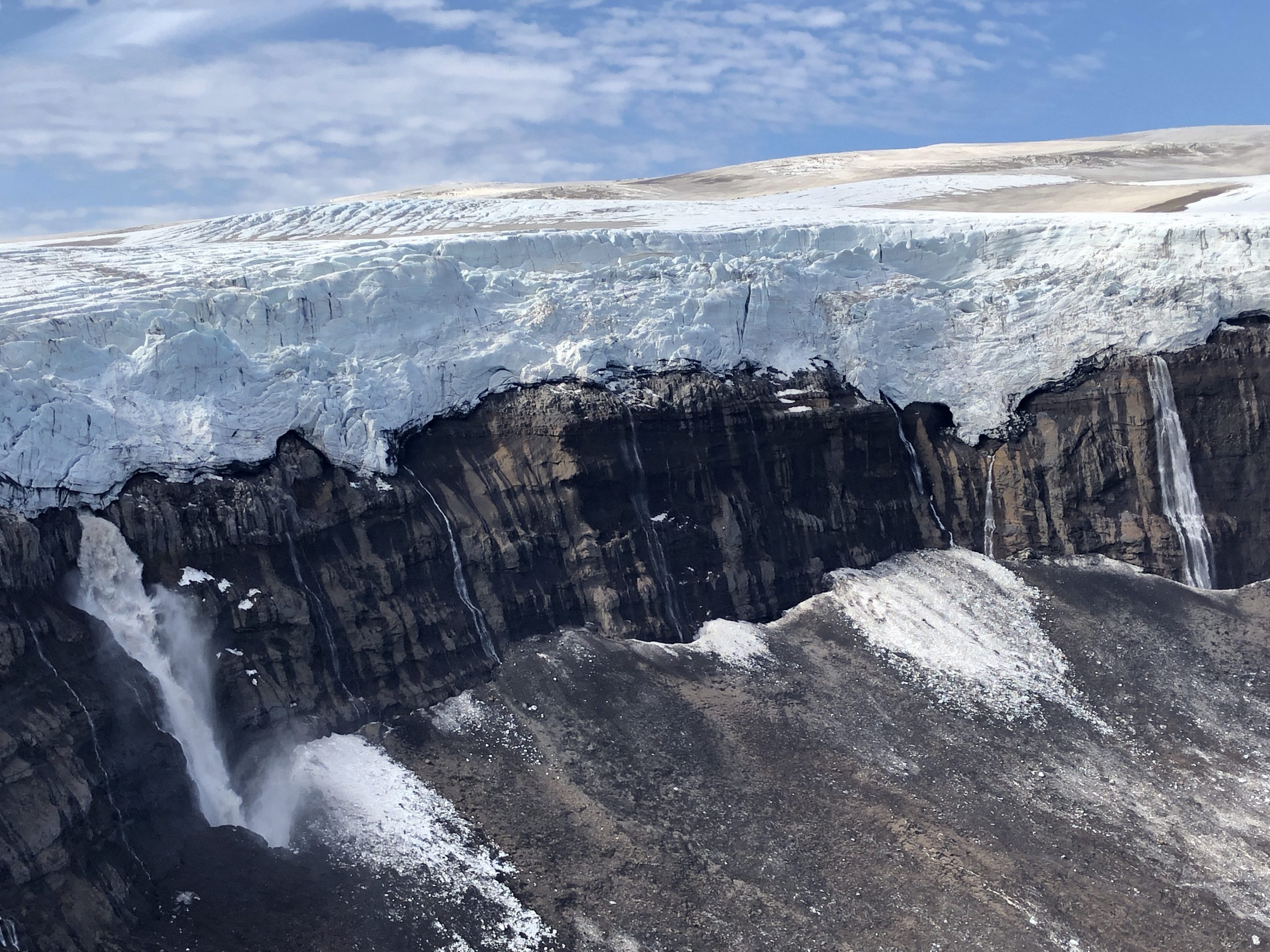
 Skálafell :: Skálafellsjökull
 Skálafell :: Skálafellsjökull
 Skálafell :: Skálafellsjökull :: the glacier lake
 Skálafell :: The Kolgrima river
 Skálafell :: The Kolgrima river
 Skálafell :: The Kolgrima river
 Jökulsárlón
 Jökulsárlón
 Jökulsárlón
 Jökulsárlón
 Jökulsárlón
 Jökulsárlón
 Jökulsárlón :: so called Diamond Beach
 Jökulsárlón :: so called Diamond Beach
 Driving from Jökulsárlón to Fjallsárlón
 Fjallsárlón
 Fjallsárlón
 Fjallsárlón
 Fjallsárlón
 Fjallsárlón
 Fjallsárlón
 Fjallsárlón
 Sandfell :: farm ruins
 Sandfell :: farm history information
 Skaftafellsjökull and Svínafellsjökull
 Skaftafell :: Hundafoss
 Skaftafell :: on the way to Svartifoss :: high mountains appear
 Skaftafell :: on the way to Svartifoss
 Skaftafell :: Svartifoss
 Skaftafell :: Sjónasker :: Skaftafellsjökull, Hrútfjall, Svínafellsjökull, Hvannadalshnúkur
 Skaftafell :: Sjónasker :: Hrútfjall, Svínafellsjökull, Hvannadalshnúkur, Öræfajökull
 Skaftafell :: Sjónasker :: Hvannadalshnúkur, Öræfajökull, the Skaftafellsá river
 Skaftafell :: Sjónasker :: Hrútfjall(tindar)
 Skaftafell :: Sjónasker :: Hvannadalshnúkur
 Skaftafell :: Sjónasker :: Skeiðarárjökull, Skaftafellsfjöll
 Skaftafell :: below Sjónasker :: Skaftafellsjökull, Hrútfjall, Svínafellsjökull, Hvannadalshnúkur, Öræfajökull
 Skaftafell :: below Sjónasker :: Hrútfjall, Svínafellsjökull, Hvannadalshnúkur
 Skaftafell :: below Sjónasker :: Svínafellsjökull, Hvannadalshnúkur, Öræfajökull
 Skaftafell :: Sel farm
 Skaftafell :: Sel farm
 Driving west to Kirkjubæjarklaustur
 Mýrdalssandur :: madness by a parking
 By Vík :: Mýrdalsjökull
 Reynisfjara :: Reynisdrangar rocks
 Reynisdrangar
 Dyrhólaey
 Dyrhólaey
 Dyrhólaey :: area closed
 Dyrhólaey :: Mýrdalsjökull
 Dyrhólaey :: Dyrhólaós lagoon
 Dyrhólaey :: selfie with Mýrdaljökull behind
 Driving F 214 up to Þakgil :: Skálarfjall and Hafursey behind the Múlakvísl river canyon
 Þakgil :: seting up the tent by a cave
 Þakgil :: ready for breakfast
 Þakgil :: the camping valley
 Þakgil :: mist in the waterfall valley above the camping
 Þakgil to Mýrdalsjökull :: up the side valley of Þakgil
 Þakgil to Mýrdalsjökull :: cottongrass
 Þakgil to Mýrdalsjökull :: green gorges above Þakgil
 Þakgil to Mýrdalsjökull :: green gorge walls
 Mýrdalsjökull edge :: approaching Höfðabrekkajökull
 Mýrdalsjökull edge :: Höfðabrekkajökull
 Þakgil to Mýrdalsjökull :: Höfðabrekkajökull and the whole lower glacier tongue
 Mýrdalsjökull edge :: Höfðabrekkajökull :: glacierfall with waterfalls
 Þakgil to Mýrdalsjökull :: Höfðabrekkajökull :: the lower glacier tongue, Kötlujökull behind
 Þakgil to Mýrdalsjökull :: Höfðabrekkajökull :: resting
 Mýrdalsjökull edge :: Höfðabrekkajökull :: Huldufjöll and Huldufoss, making photos
 Þakgil to Mýrdalsjökull :: Höfðabrekkajökull :: Huldufoss
 Mýrdalsjökull to Þakgil :: mossy morraine lakes below Höfðabrekkajökull
 Descending to Þakgil :: moss
 Descending to Þakgil :: back on the Sker morraine :: conical Mælifjell, montains bove Vík
 Descending to Þakgil :: a glacial river gorge begins, mountains above Vík behind
 Descending to Þakgil :: Hjörleifshövði far on the horizon
 Descending to Þakgil :: Skálafjell and Mýrdalssandur far behind
 Descending to Þakgil :: bizarre rocks, green gorge walls
 Descending to Þakgil :: camping in sight
 By Þakgil :: cottongrass
 Þakgil :: driving F214 back to the coast
 Hjörleifshövði :: leaving the parking
 Hjörleifshövði :: the view towards Vík opens
 Hjörleifshövði :: Hjörleifhaugur :: the Viking grave
 Hjörleifshövði :: the Danish surveyors monument
 Hjörleifshövði :: the 19th century cemetery platform
 Hjörleifshövði :: the Bautakvísl estuary
 Hjörleifshövði :: the view towards Vík
 Hjörleifshövði :: on the way to the farm ruins
 Hjörleifshövði :: farm ruins
 Hjörleifshövði :: southern walls
 Hjörleifshövði :: crossing a lupin field to the parking
 Skógafoss
 Skógafoss
 Seljalandsfoss :: crowded
 Seljalandsfoss
 Seljalandsfoss
 Seljalandsfoss :: walking behind the waterfall
 Seljalandsfoss :: walking behind the waterfall
 Seljalandsfoss :: walking behind the waterfall
 Leirubakki :: camping life
 Leirubakki :: cooking
 Leirubakki :: hot springs discreetly photographed
 Hellisheiðarvirkjun thermal power station
 Reykjavík :: Hallgrimskirkja
 Reykjavík :: Hallgrimskirkja
 Reykjavík :: Hallgrimskirkja
 Reykjavík :: Hallgrimskirkja
 Reykjavík :: Hallgrimskirkja
 Reykjavík :: Skólavördurstígur
 Reykjavík :: Skólavördurstígur
 Reykjavík :: Skólavördurstígur
 Reykjavík :: Bankastræti
 Reykjavík :: Bæjartorg :: The hot dog stand
 Reykjavík :: the Tjörnir lake bird
 Reykjavík :: Ráðhús
 Reykjavík :: Aðalstræti 12
 Reykjavík :: Aðalstræti 10
 Reykjavík :: in the harbour
 Reykjavík :: Harpa
 Reykjavík :: Harpa :: glas exterior
 Reykjavík :: Harpa :: glas interior
 Reykjavík :: Sólfar
 Reykjavík :: Hallgrimskirkja
 Keflavík :: self-check-in
 Keflavík :: flying home :: Svartensvirkjun (Blue Lagoon) , best watched with… a smartphone.
As an addition we recommend Jacek’s blog post about Hjörleifshövði (you will be redirected).